Hikes
A Guided Hike of Lugnaquilla Mountain
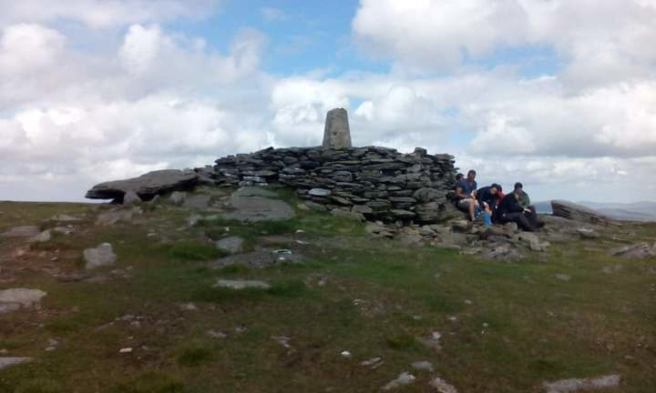
Lugnaquilla (Irish: Log na Coille, meaning “hollow of the wood”), at 925 metres (3,035 ft)
Leaving the car park we’ll make our way up through foresty trails leading up to the scenic fraughan rock glen and head up along beside the waterfall to open mountain as we make our way for the Summit of Lugnaquilla at 925 meters. Glen of Imaal Army firing range will be to our right on our ascent. On the clear day views are stunning from the summit.
We’ll take lunch here at the summit weather permitting. Leaving lugnaquilla summit we will make our across to Cloghernagh summit at a height of 800 meters. And a great few of Kelly’s lough.
A short break here before our descend to the Zigzags trail. And down to the road in which we’ll have short road walk back to Baravore carpark.
Distance 16.5km,Terrain trails & open mountain. Grade Hard hike. Loop Hike.

Tonelagee Mountain & The Heart Shaped Lake
Leaving the carpark we will start our ascent of Tonelagee straight away till we reach the Summit. (At a easy pace) With a short break here taking the in stunning views at Tonelagee summit. After this it’ll be short walk to cliffs of Tonelagee for the stunning views of the heart shaped lake. And make our way down to a slightly boggy section and head for Brockagh Mountain and continue our way down to the St kevins way trail with more stunning views along this route back to the carpark.
All hikes are guided by Qualifed Mountain leaders
Tonelagee (Irish: Tóin le Gaoith, meaning “backside to the wind at 817 metres (2,680 ft), is the 25th–highest peak in Ireland on the Tonelagee is situated in the central sector of the Wicklow Mountains range, and sits on the main “central spine” of the range that runs from Kippure in the north, to Lugnaquillia in the south; and in particular, the continuous “central boggy ridge” that runs from the Sally Gap in the north, via Mullaghcleevaun, to Tonelagee & is the third highest peak in Wicklow after Lugnaquilla and Mullaghcleevaun.

Guided Hike of Derrybawn Ridge & Mullacor Mountain.
Meeting Point, Glendalough visitors center.
Leaving here we’ll take the old green road & trails of Derrybawn woodlands. As we make our up for the Ridge of Derrybawn. Once at the summit there are fantastic views of Glendalough valley. After a short break we’ll make our way across the scenic Derrybawn Ridge line and make our acsent for Mullacor mountain summit. Views of Lugnaquilla from here also on a good day. We’ll make our way down for the scenic wicklow way trail and this will take use back to Glendalough.
Mullacor (Irish: Mullaigh Mhór, meaning (big hilltop)at 661 metres (2,169 ft), Mullacor is situated in the southern sector of the wicklow Mountains.
Moderate Hike, Loop Hike, Terrain open mountain & forest trails.

Little Sugarloaf & Bray Head Guided Hike
Starting point Belmont Demesne
Outside Bak,d at Arthur’s cafe.
From here we’ll take a section of the Belmont Way trail as we make our up for the Little Sugar loaf. As we reach the summit of the little Sugarloaf great views inland of the wicklow Mountains and coastal views. We’ll drop down through forest trails as we make our way through kilruddery estate before making our way up for Bray Head with fabulous coastal views.While staying on the higher trail we’ll link up with the Belmont way trail and make our for windgates and back to the Belmont Demesne through woodland trails.
Moderate hike
Distance 13km
Open hillside
Terrain Trails & Open hillside.

Brockagh Mountain & St Kevin’s Way
Meeting at the Glendalough visitors centre.
From here we will take a short section of the scenic Wicklow Way Trail before making our way up the spur for Brockagh East Summit with fantastic views of Glendalough Valley along the way. At the summit at a height of (470m) there are views also of the Glenmacnass Waterfall. After some lunch we’ll leave our first summit we’ll head for the other Brockagh Mountain Summit at a hieght of (540m) with views of Tonelagee, Camaderry Mountain. From here we’ll make our down to the St kevins way trail to the old mining works on our route back to Glendalough.
Moderate hike, Distance 13km, Terrain Trails & Open mountain. Loop hike.